|
Click below
on Thumbnail for full size map: |
Description of
Map |
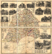 |
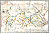
Chester County - Map of
Chester Co. Pennsylvania, from Actual Surveys, Published by T.J.
Kennedy, 1860 (222kb) |
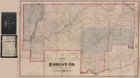 |
Forest County - Map of
Forest Co. Pennsylvania, Compiled from Records & Official Surveys by
S.D. Irwin (Philadelphia: J.L. Smith, 1881) (152kb) |
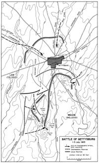 |
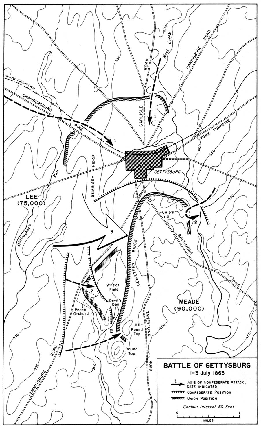
Gettysburg - Battle of
Gettysburg (July 1-3, 1863) (213kb) |
_small.gif) |
Lower Merion - Township of Lower Merion,
Montgomery County. (John Levering, 1851; Republished: A.H.
Mueller, 1908) (302kb) |
 |
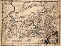
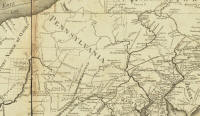
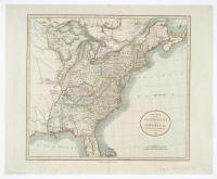
Pennsylvania - A Map of
Some of the South and Eastbounds of Pennsylvania in America, Being
Partly Inhabited. (London: John Thornton/John Seller, 1681) (1.1Mb)
|
 |
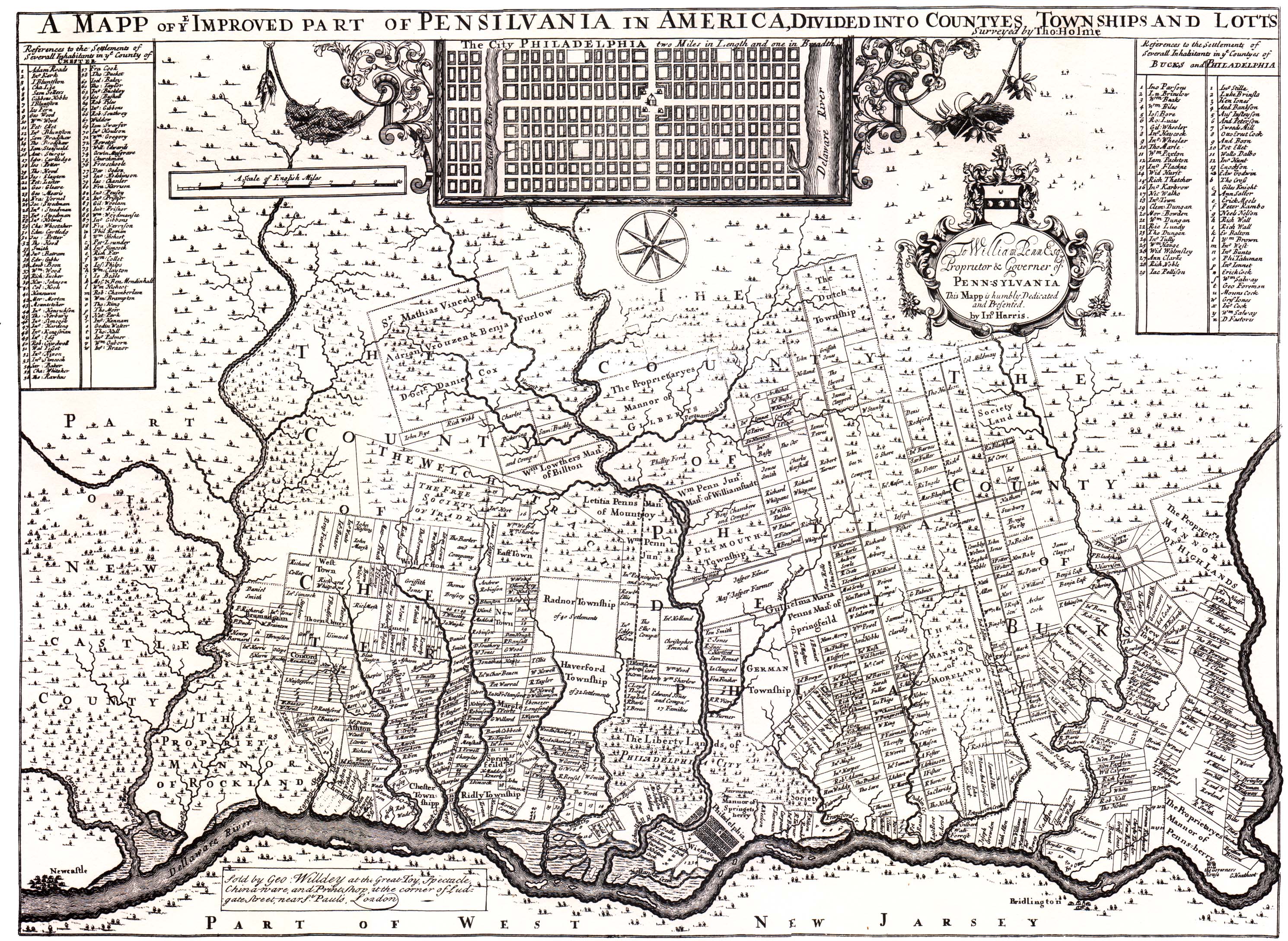
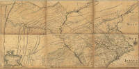
Pennsylvania - A Mapp of
Ye Improved Part of Pensilvania in America, Divided in Countyes,
Townships and Lotts. Surveyed by Tho: Holme. (London:
George Willdey, 1687) (1.4Mb) |
 |
Pennsylvania -
Pensilvania, By John Seller (1690) (836kb) |
 |
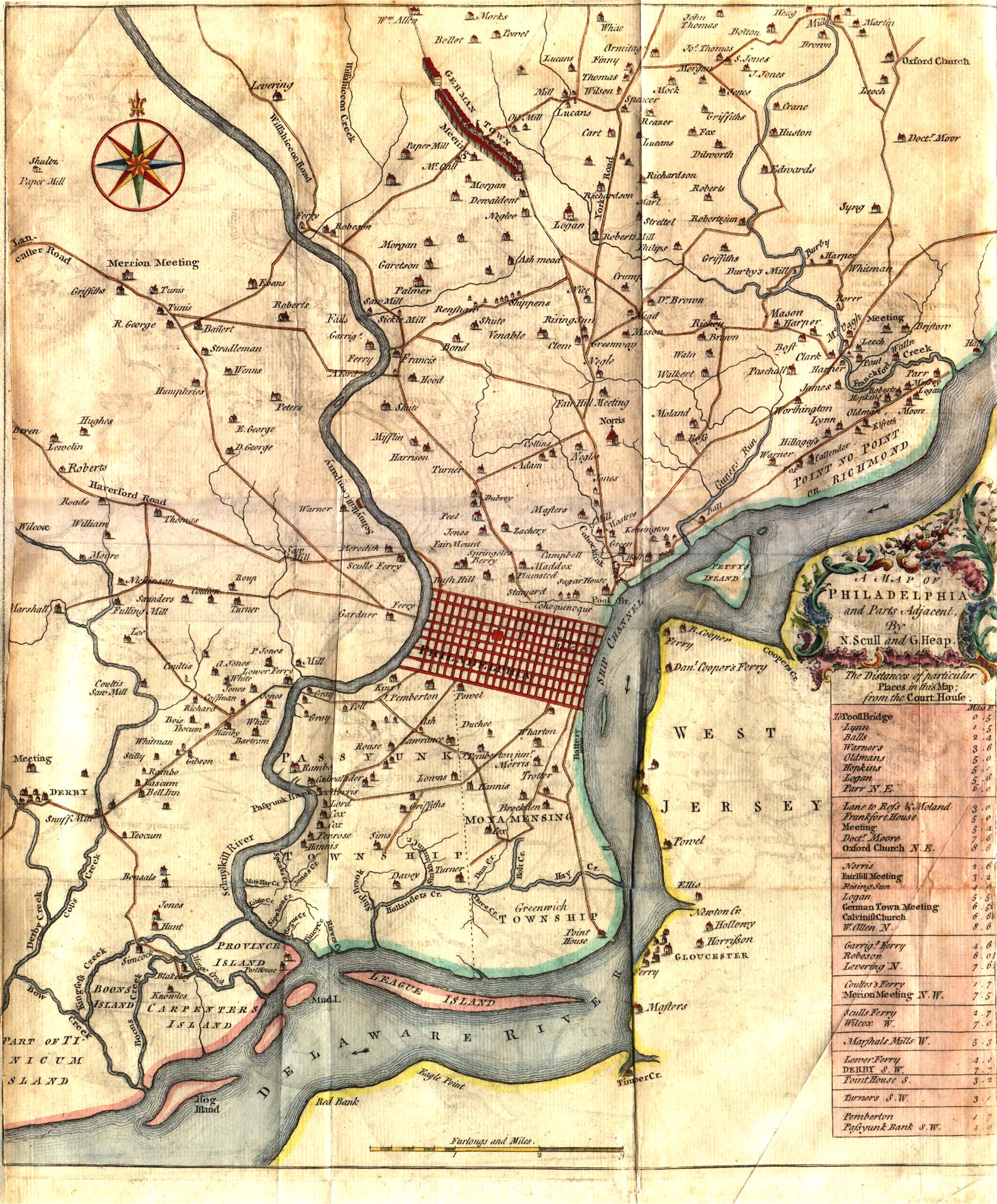
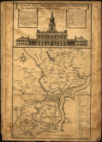
Pennsylvania - A Map of
Philadelphia and Part Adjacent, By N. Scull and G. Heap (1753)
(798kb) |
 |
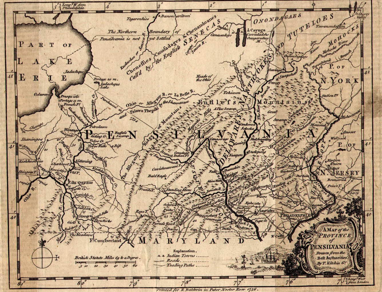
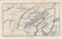
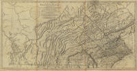
Pennsylvania - A Map of
the Province of Pensilvania, Drawn from the Best Authorities.
By T. Kitchin. (London: R. Baldwin, 1756) |
 |
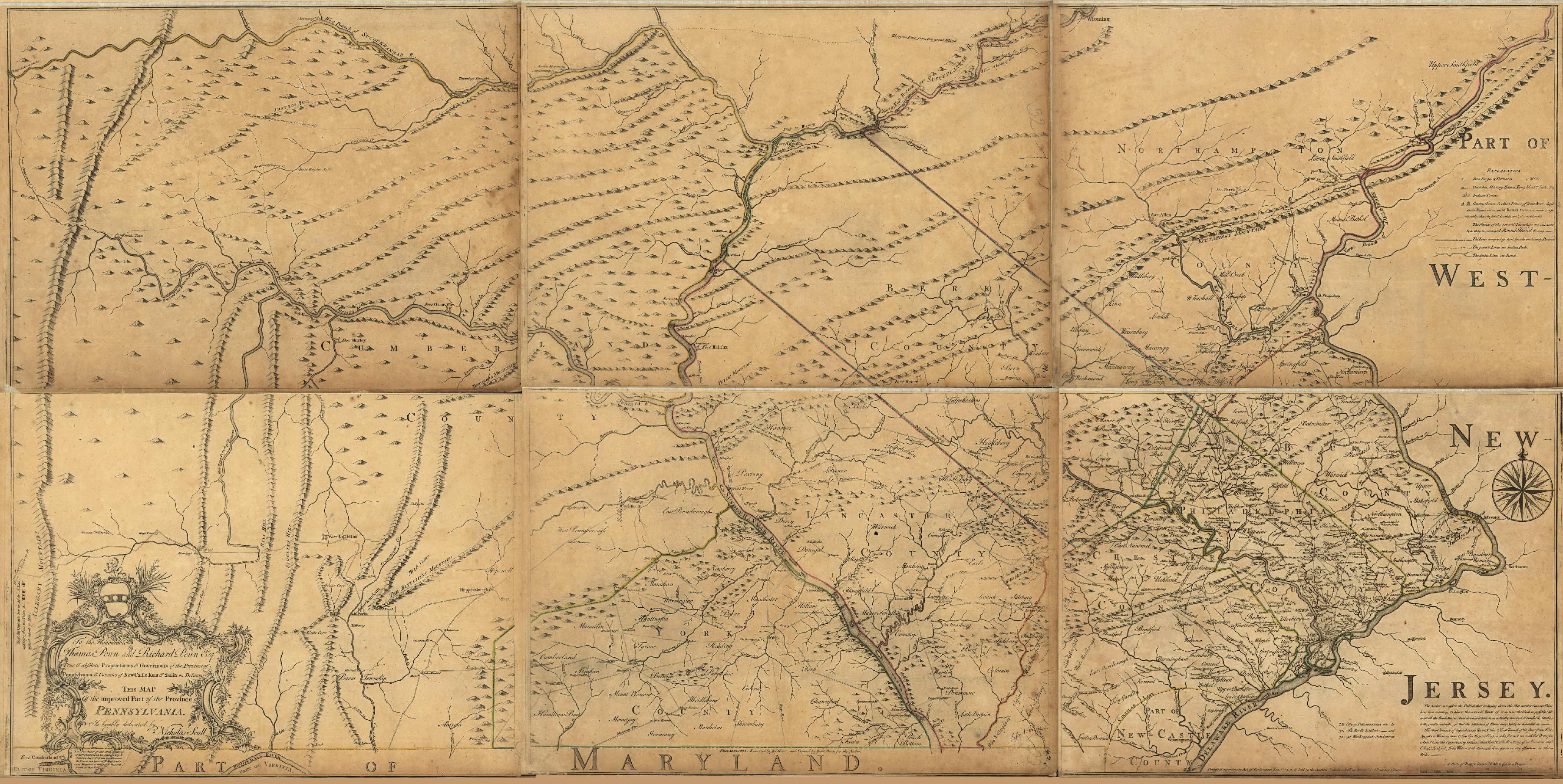
Pennsylvania - Map of the
Improved Part of the Province of Pennsylvania. By Nicholas
Scull. (1759) (1.0Mb) |
 |
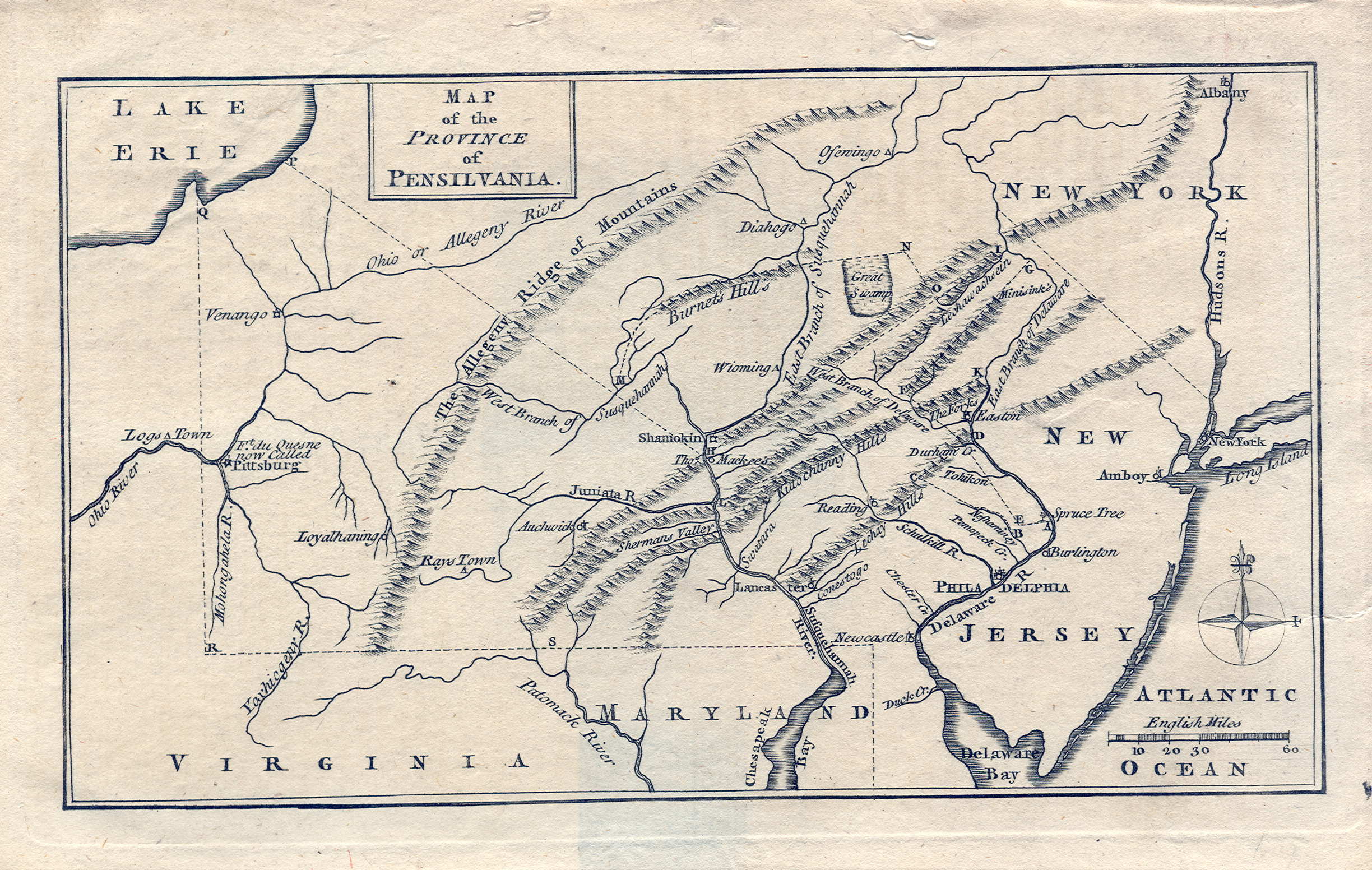
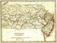
Pennsylvania - Map of the
Province of Pensilvania (Orig. publ. London: Gentleman's Magazine,
1775) (623kb) |
 |
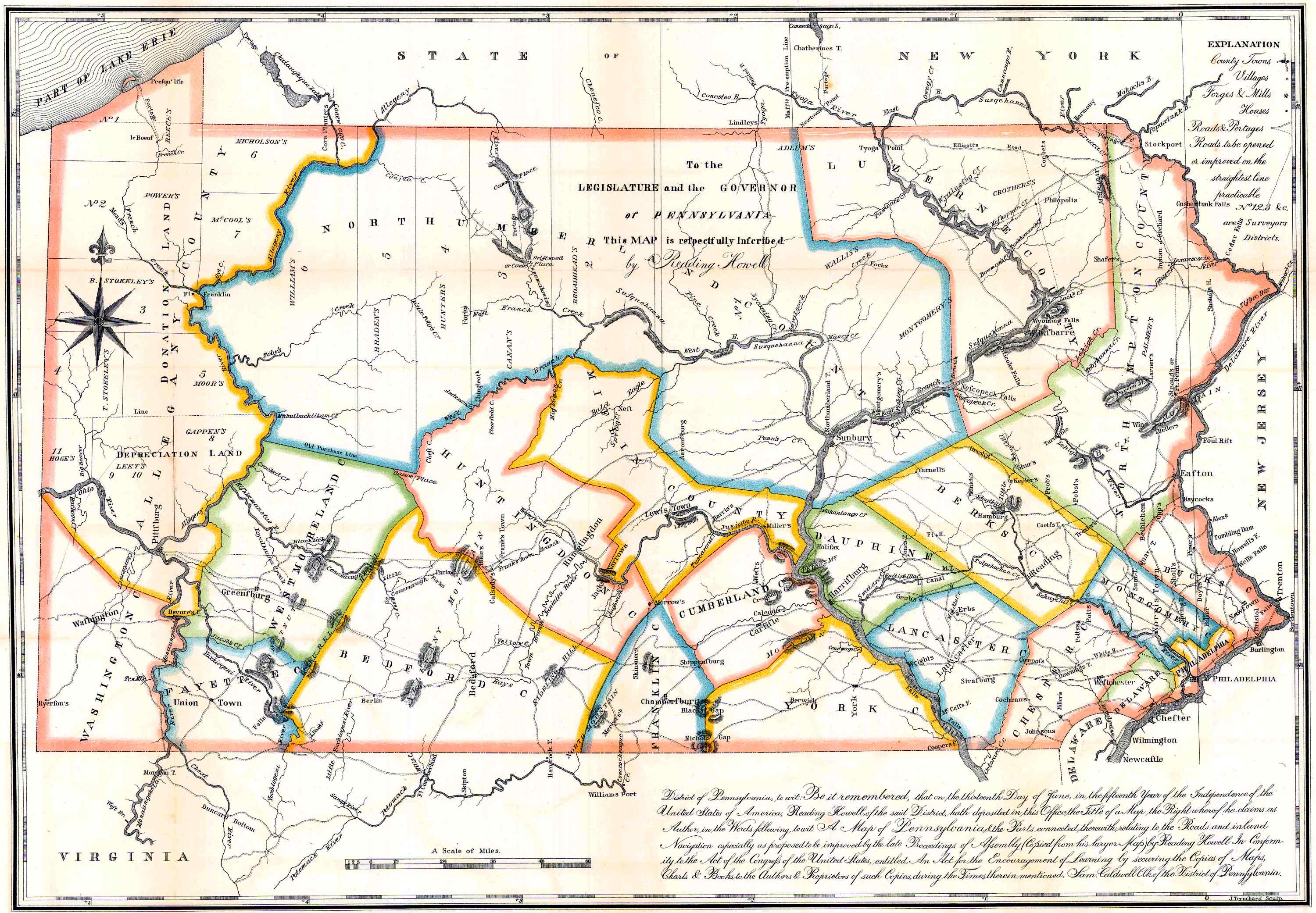
Pennsylvania - A Map of
Pennsylvania, & the Parts Connected Therewith, Relating to the Roads
and Inland Navigation (Sculp, 1791) (705kb) |
 |
Pennsylvania - From A Map
of the United States (with post roads and distances) (1796) - By Abraham
Bradley, Jr. (308kb) |
 |
Pennsylvania - Railroad
Lines, 1829 (Philadelphia: A. Finley, 1829) (5.3Mb) |
 |
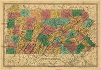
Pennsylvania -
Pennsylvania and New Jersey (Boston: Thomas Bradford, 1835) (599kb)
|
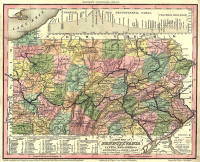 |
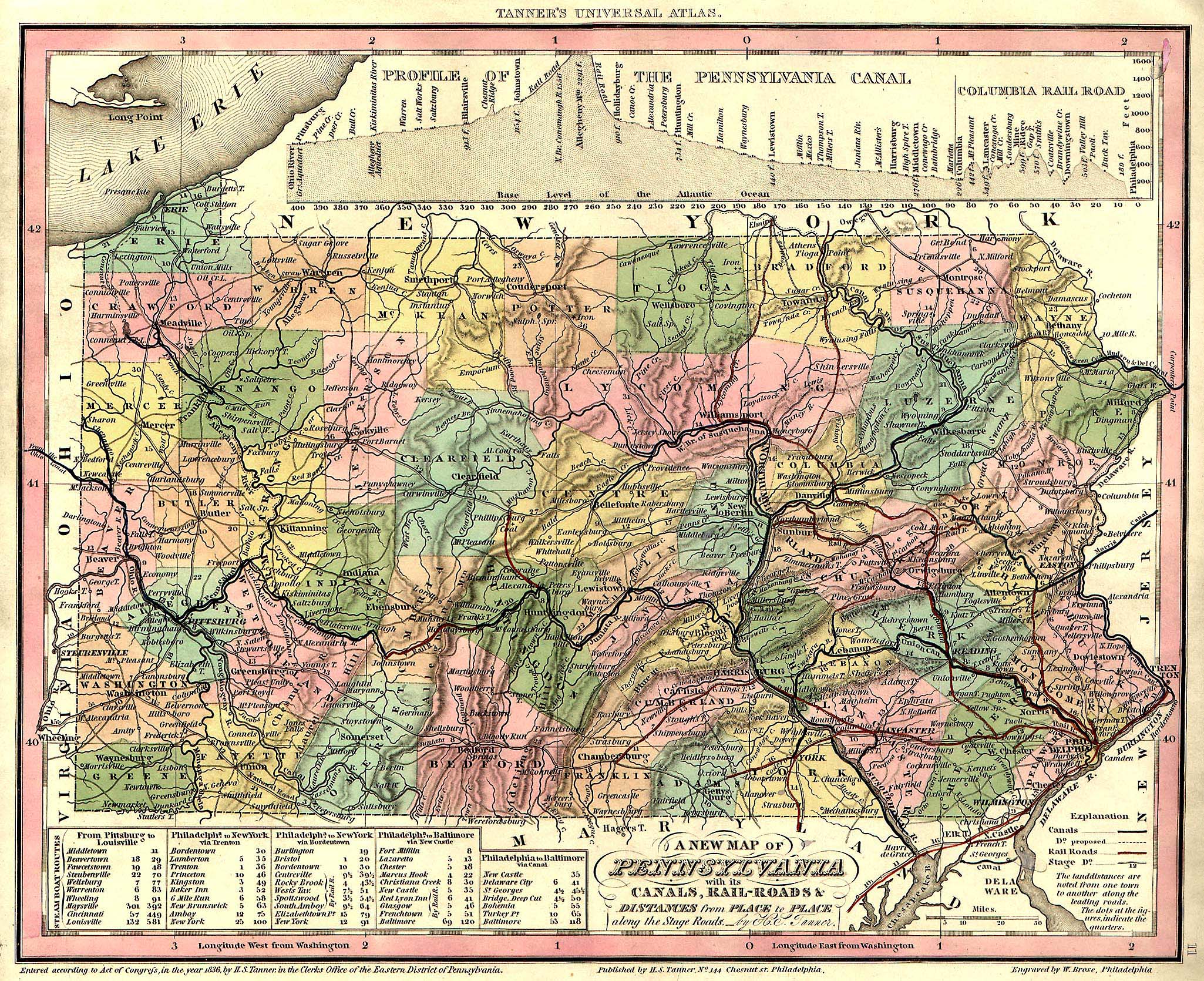
Pennsylvania - A New Map
of Pennsylvania, with its Canals, Rail-Roads & Distances from Place
to Place Along the Stage Roads (Philadelphia: H.S. Tanner, 1836)
(1.17Mb) |
 |
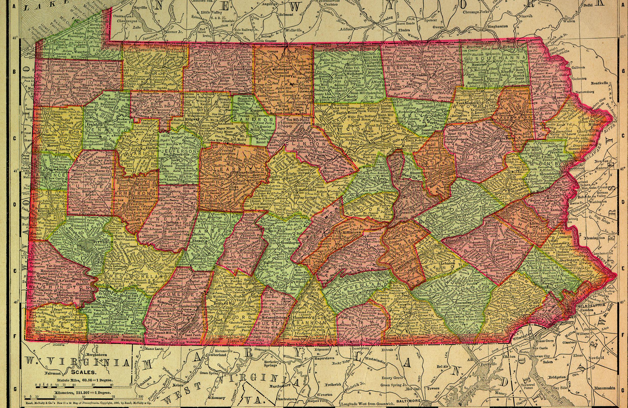
Pennsylvania - Rand
McNally (1895) (1.78Mb) |
 |
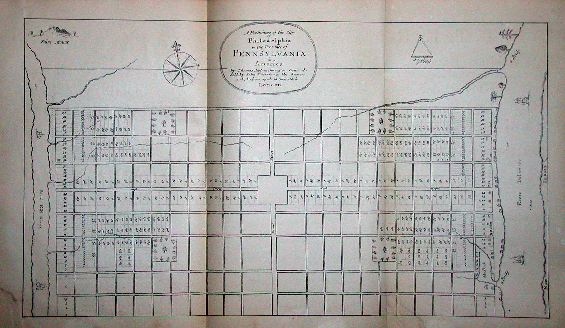
Philadelphia - A
Portraiture of the City of Philadelphia in the Province of
Pennsylvania in America. By Thomas Holme, Surveyor General.
(London: John Thornton/Andrew Soule, 1683) (266kb) |
 |
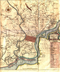
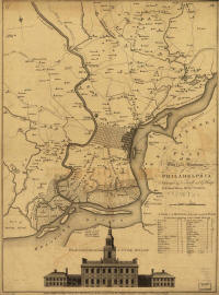
Philadelphia - A Map of
Philadelphia and Parts Adjacent, with a Perspective View of the
State-House, by N. Scull and G. Heap (1752) (2.7Mb) |
 |
Philadelphia - A Map of
Philadelphia and Parts Adjacent, by N. Scull and G. Heap (1753)
(798kb) |
 |
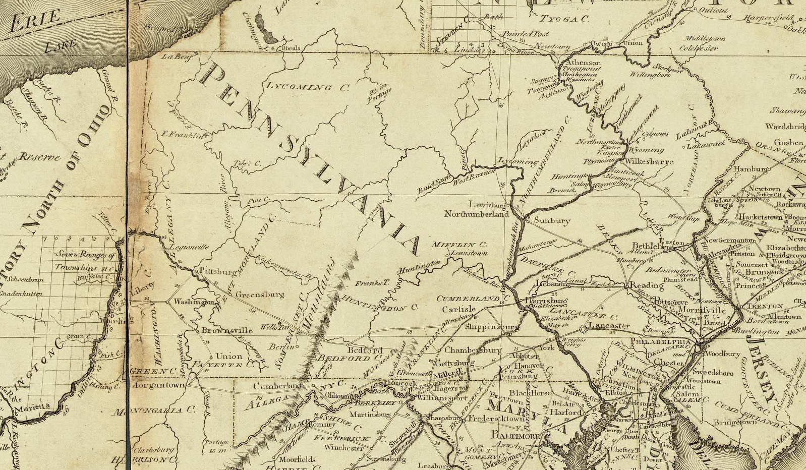
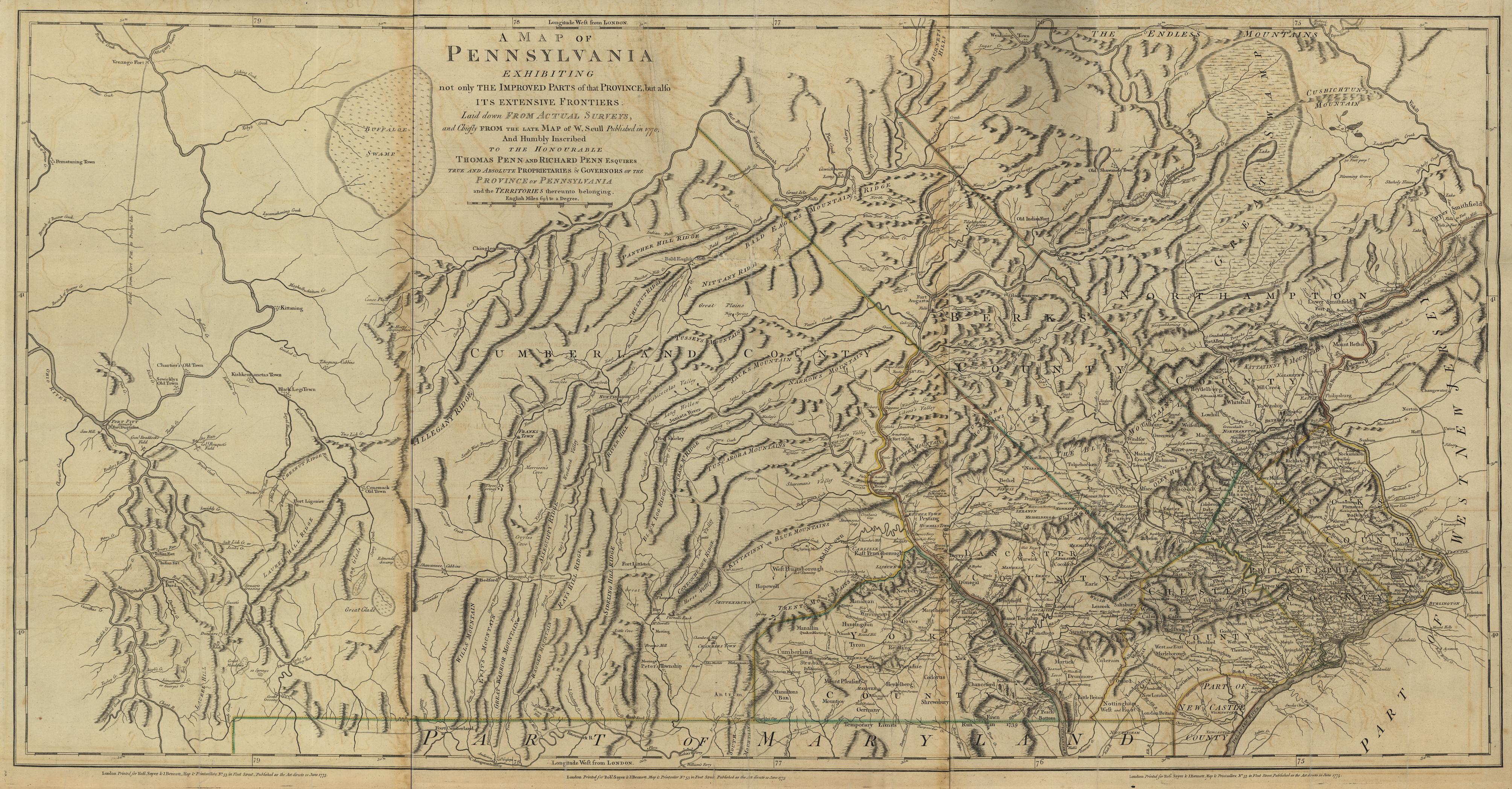
Philadelphia - A Map of
Pennsylvania, Exhibiting Not Only the Improved Parts of That
Province, but Also Its Extensive Frontiers. . .From the Late Map of
W. Scull. (London: Sayer and Bennett, 1775) (1.8Mb) |
 |
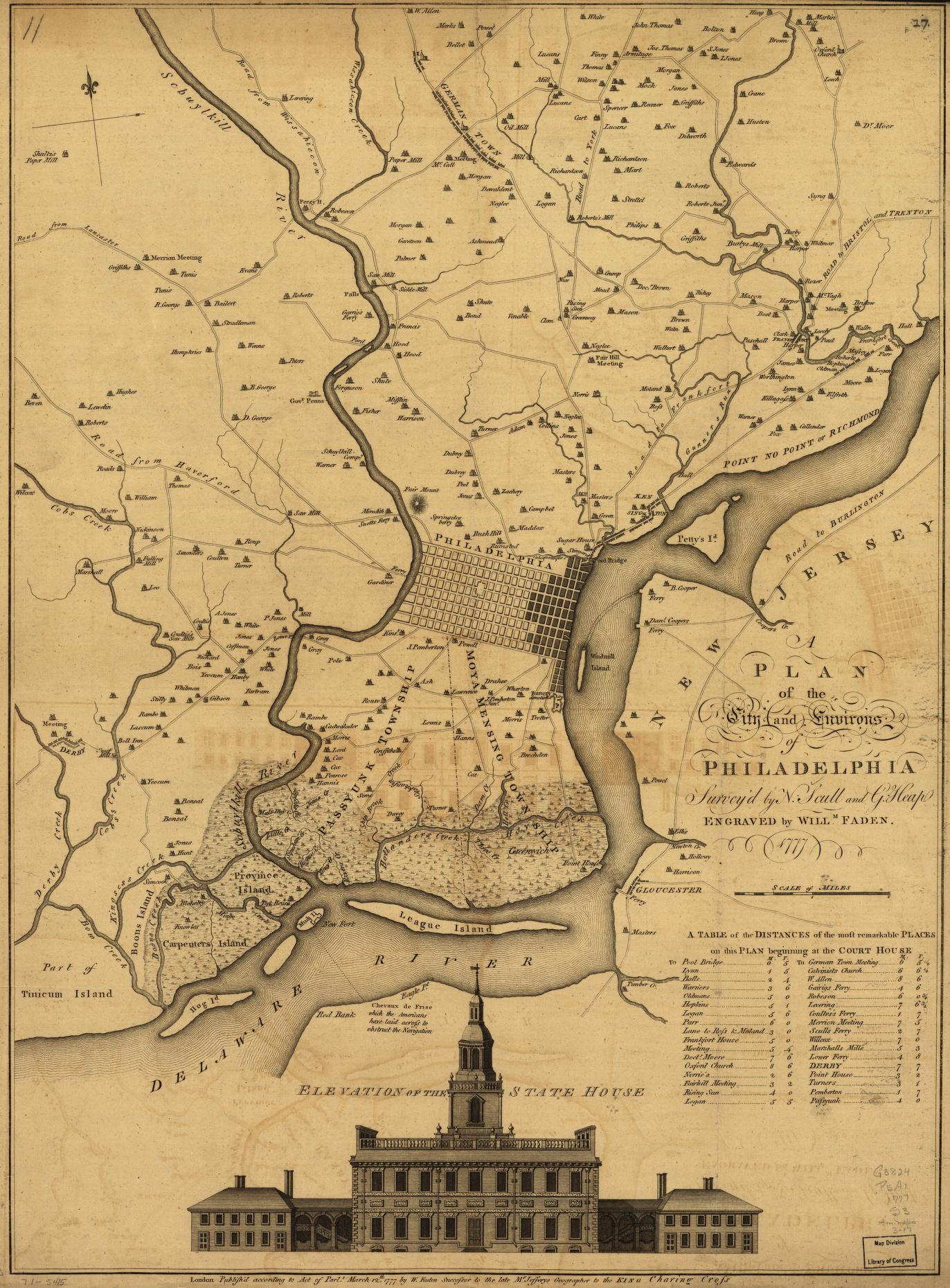
Philadelphia - A Plan of
the City and Environs of Philadelphia. Survey'd by N. Scull
and G. Heap. Engraved by Willm. Fadden. (London, 1777)
(473kb) |
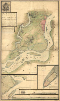 |
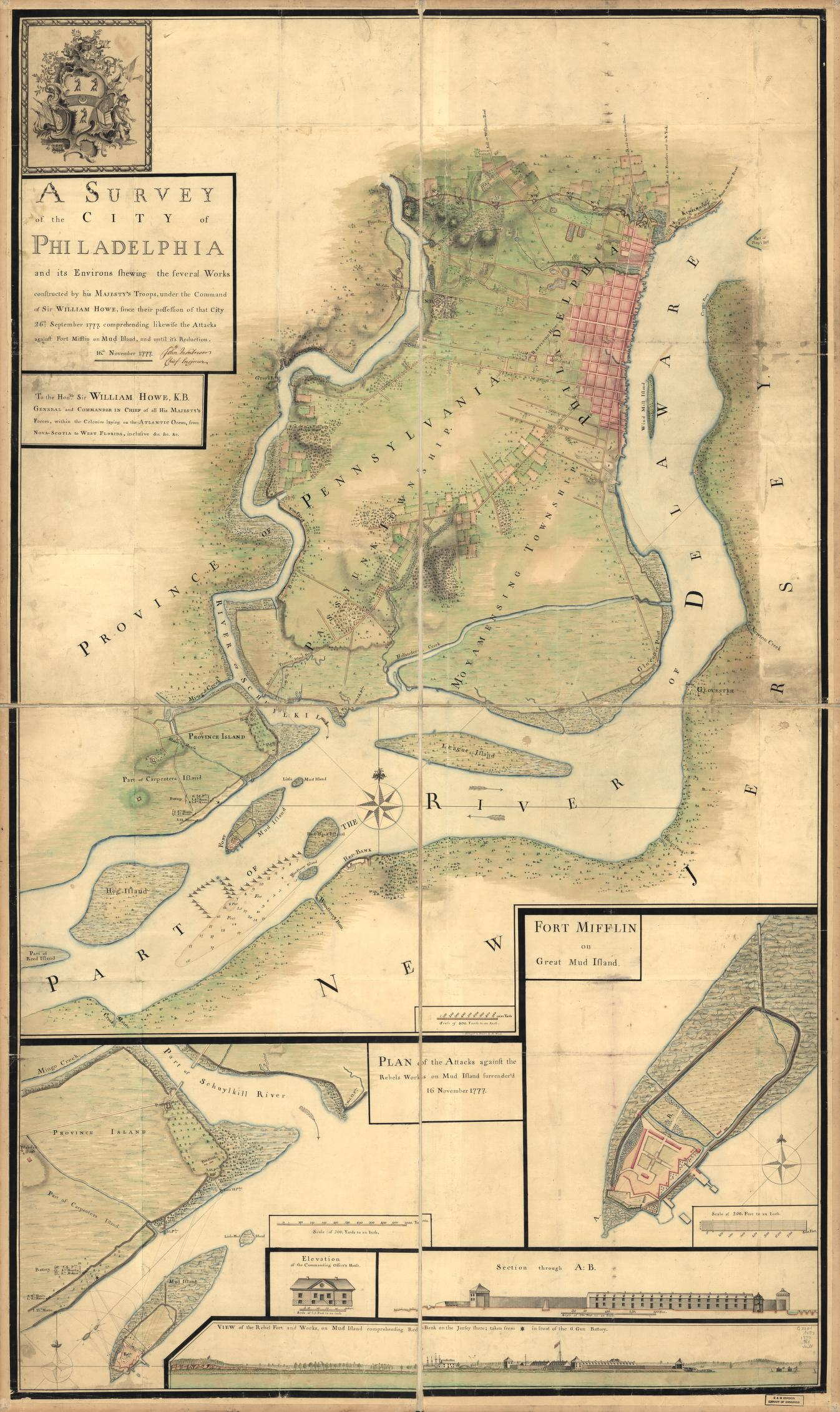
Philadelphia - A Survey of
the City of Philadelphia and its Environs showing the Several Works
Constructed by his Majesty's Troops Under the Command of Sir William
Howe, Since Their Possession of the City 26th September, 1777. . .16
November, 1777 (456kb) |
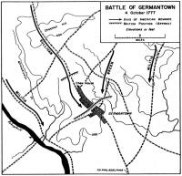 |
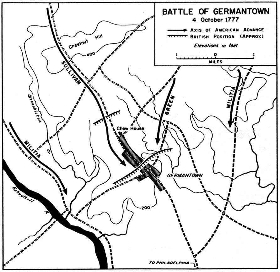
Philadelphia - Battle of
Germantown (October 4, 1777) (125kb) |
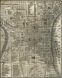 |
Philadelphia - Map of
Philadelphia - From H.S. Tanner, The American Traveller; or Guide
Through the United States (New York, 1842) (413kb) |
 |
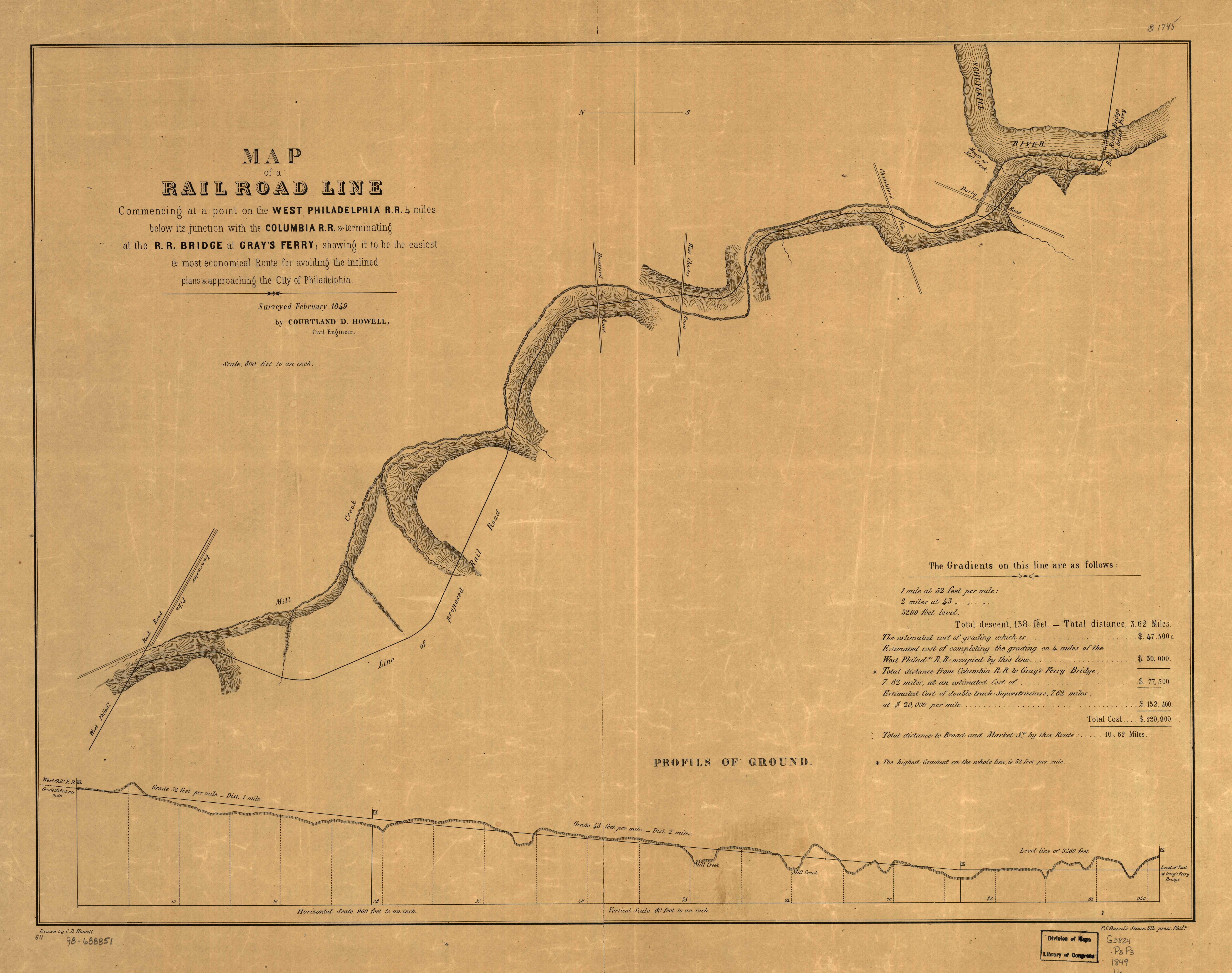
Philadelphia - Map of the
Rail Road Line, Commencing at a Point on the West Philadelphia R.R.
4 Miles Below its Junction with the Columbia R.R. & Terminating at
the R.R. Bridge at Gray's Ferry; . . . Surveyed February 1849
(Philadelphia: P.S. Duval, 1849) (2.6Mb) |
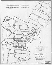 |
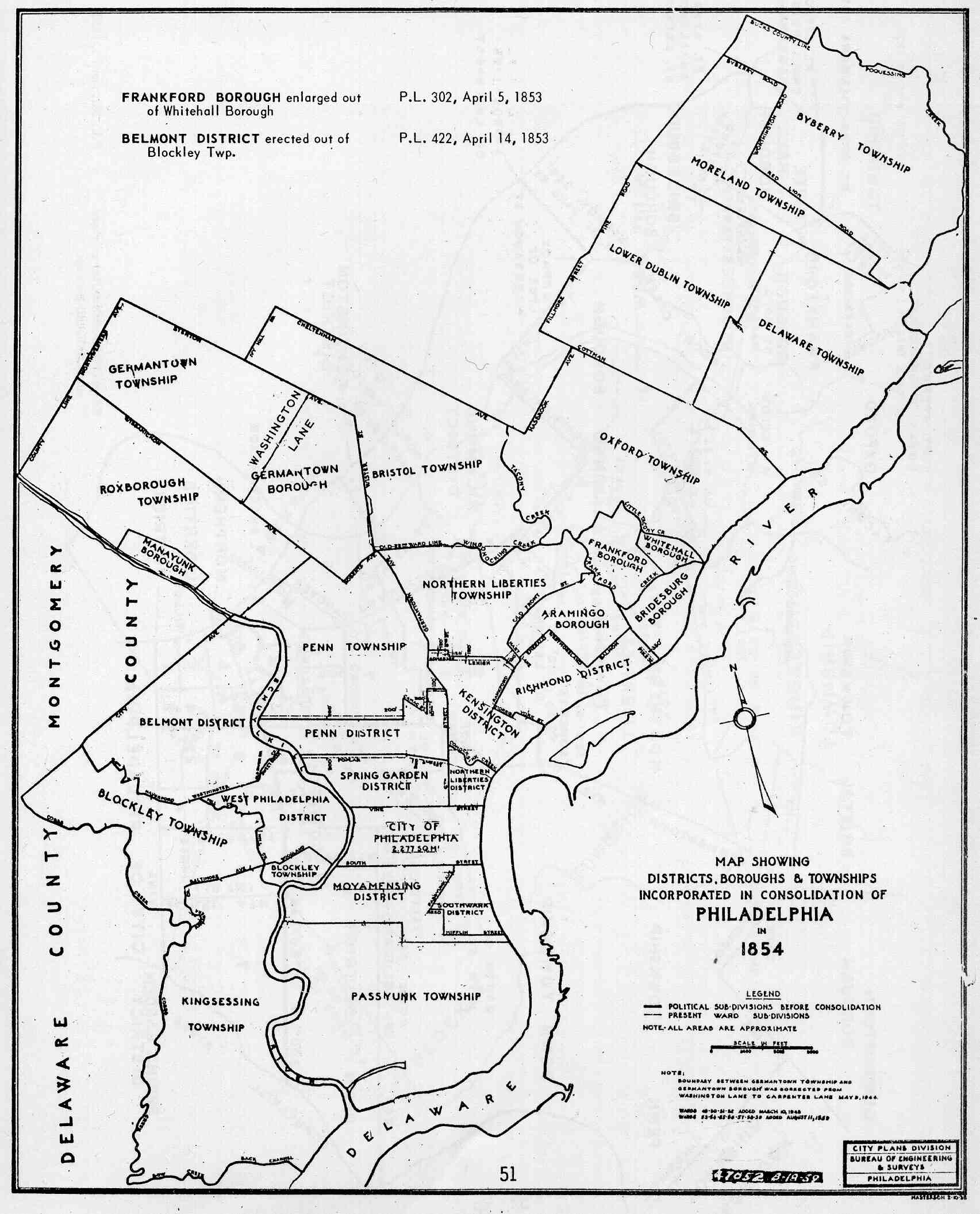
Philadelphia - Map Showing
Districts, Boroughs & Townships Incorporated in Consolidation of
Philadelphia in 1854 - From John Edward Daly & Allen Weinberg,
Genealogy of Philadelphia County Subdivisions (2nd ed.;
Philadelphia: Dept. of Records, 1966) (213kb) |
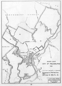 |
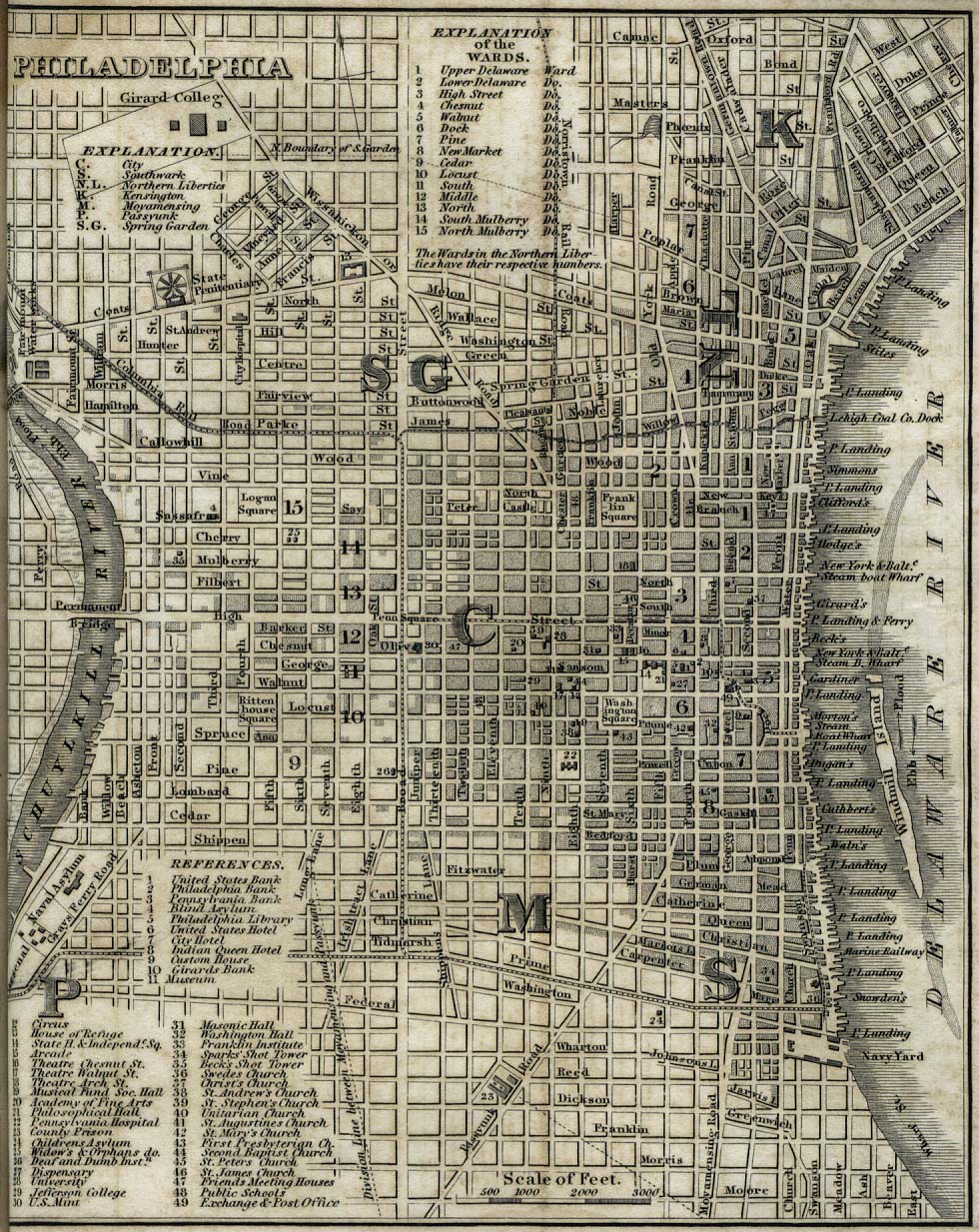
Philadelphia - Ward Map,
City of Philadelphia 1855 - From John Edward Daly & Allen Weinberg,
Genealogy of Philadelphia County Subdivisions (2nd ed.;
Philadelphia: Dept. of Records, 1966) (216kb) |
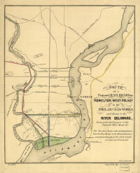 |
Philadelphia - Route of a
Proposed Rail Road from Powelton, West Philada to the Philada Gas
Works, and Thence to the River Delaware (Philadelphia: A. Kellner,
1856) (2.9Mb) |
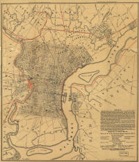 |
Philadelphia - Proposed
plan for new vision of railroad transportation into the City of
Philadelphia - Dedicated to the City of Philadelphia Through the
Directors of the Pennsylvania Railroad Company; Plan No. 2 Exhibits
the Streets with the Present Railroads Removed; the Red Lines Show
the Proposed Location of the Different Railroads Entering the City.
. .1857-58 (Philadelphia: T. Sinclair, 1858) (4.8Mb) |
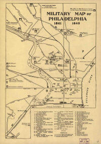 |
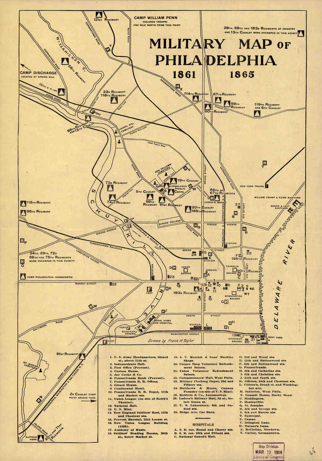
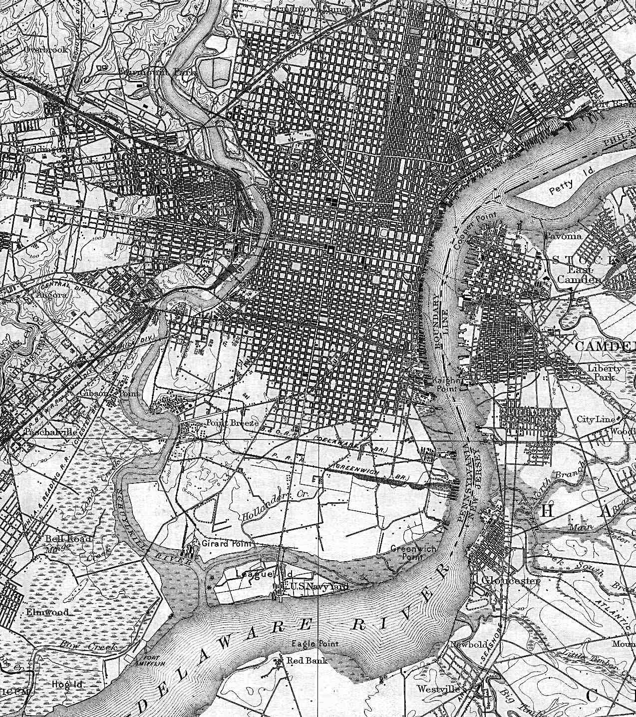
Philadelphia - Military
Map of Philadelphia, 1861-1865 (publ. ca. 1914) (173kb) |
 |
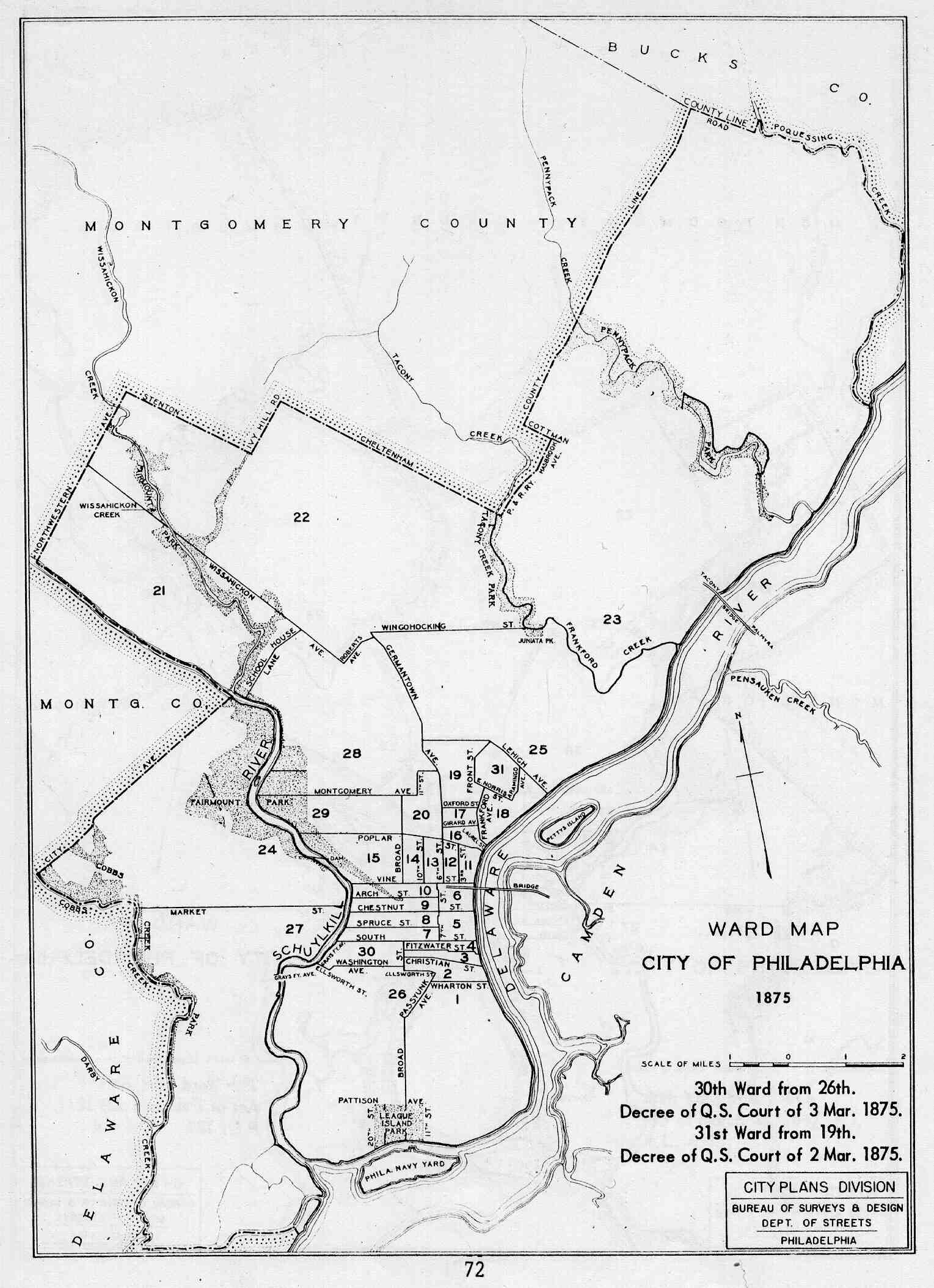
Philadelphia - Ward Map,
City of Philadelphia 1875 - From John Edward Daly & Allen Weinberg,
Genealogy of Philadelphia County Subdivisions (2nd ed.;
Philadelphia: Dept. of Records, 1966) (215kb) |
 |
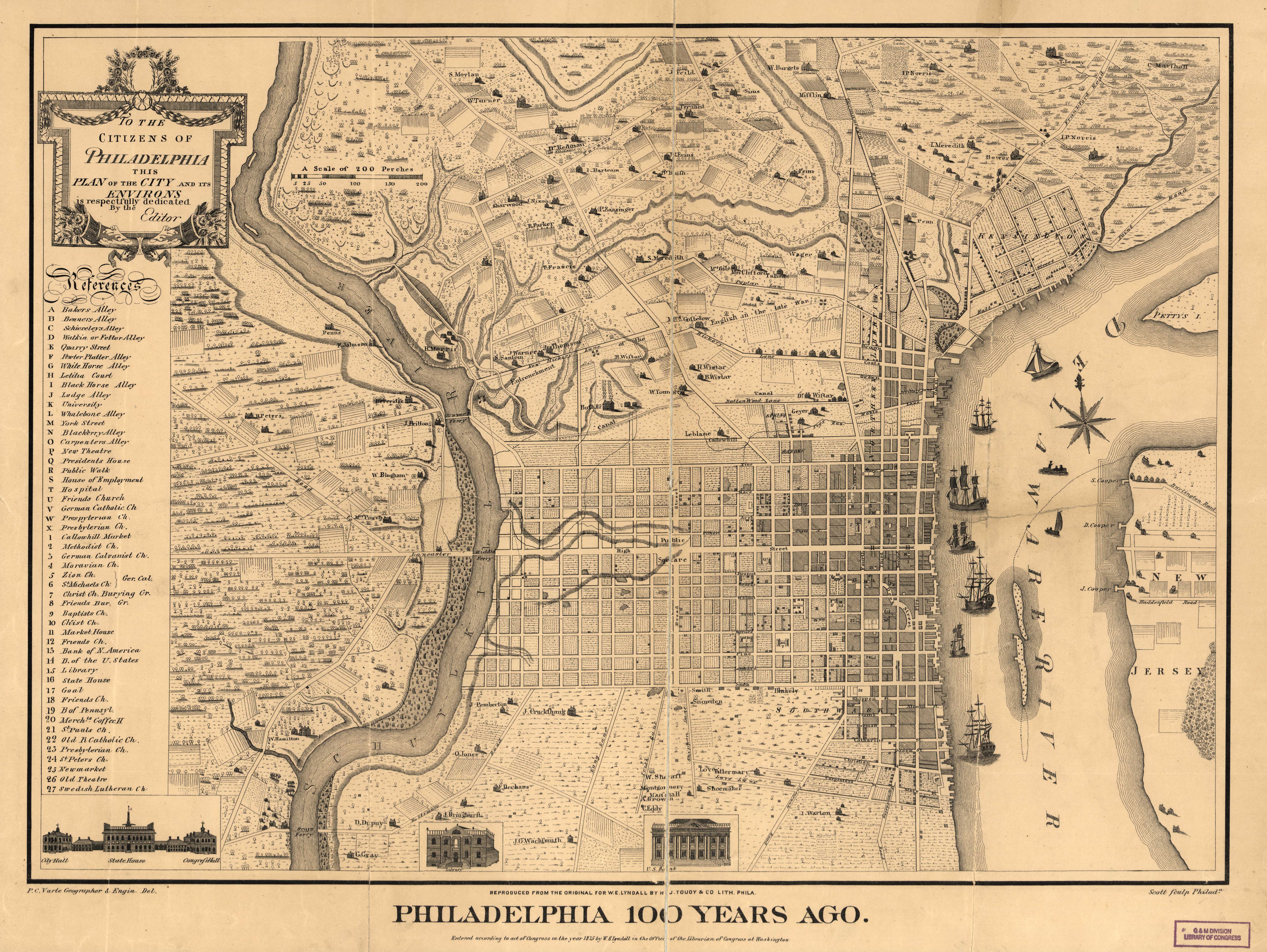
Philadelphia -
Philadelphia 100 Years Ago (1875) (5.3Mb) |
 |
Philadelphia (1898)
(503kb) |
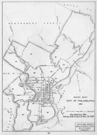 |
Philadelphia - Ward Map,
City of Philadelphia 1899 - From John Edward Daly & Allen Weinberg,
Genealogy of Philadelphia County Subdivisions (2nd ed.;
Philadelphia: Dept. of Records, 1966) (186kb) |
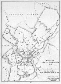 |
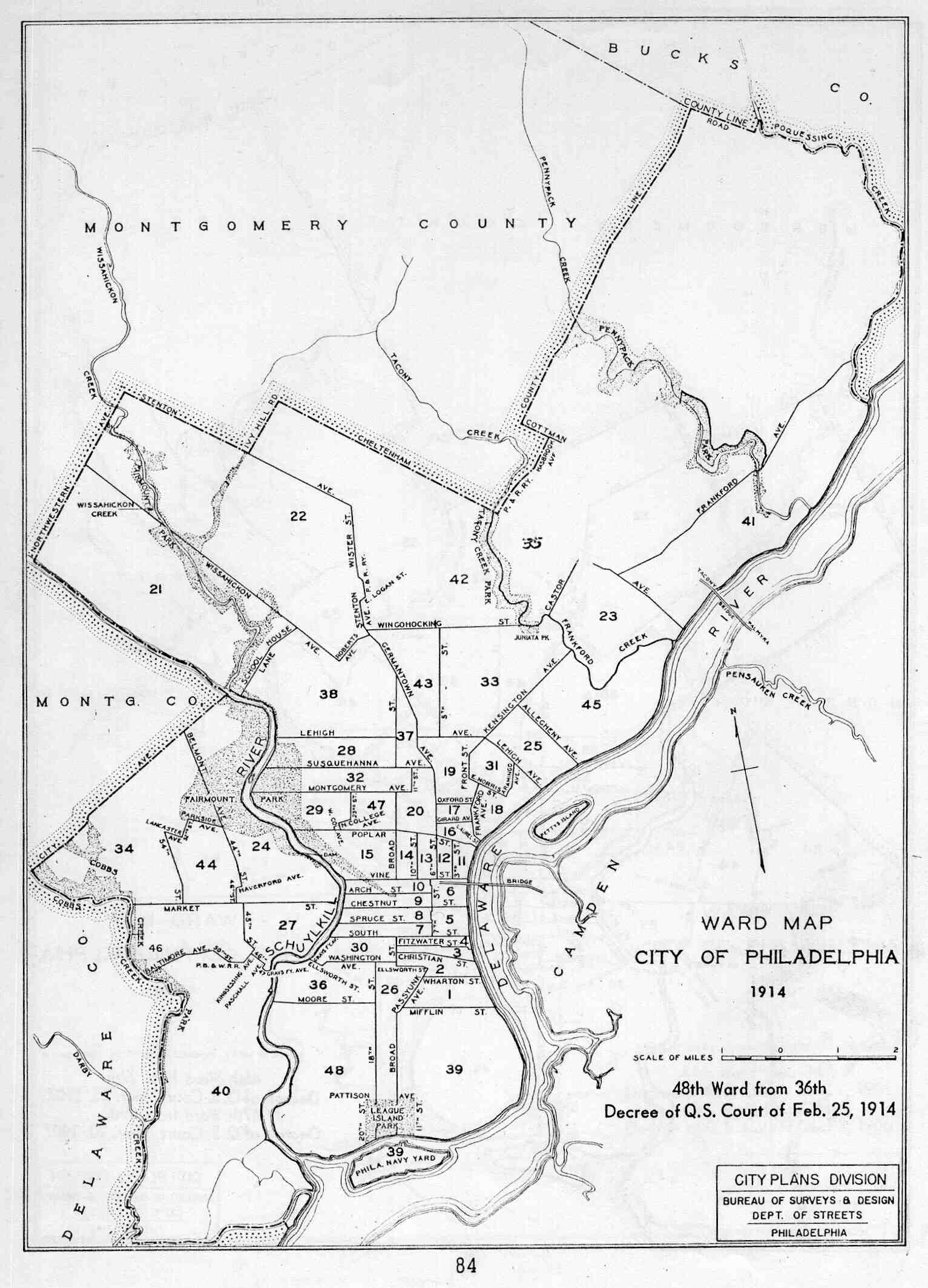
Philadelphia - Ward Map,
City of Philadelphia 1914 - From John Edward Daly & Allen Weinberg,
Genealogy of Philadelphia County Subdivisions (2nd ed.;
Philadelphia: Dept. of Records, 1966) (202kb) |
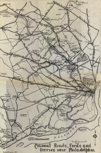 |
Philadelphia - Colonial
Roads, Fords and Ferries Near Philadelphia - By Douglas Macfarlan
(1934) (584kb) |
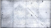 |
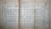
Pittsburgh - Plan of the
Lots Laid Out at Pittsburg and the Coal Hill - John Hills
(Philadelphia, 1787) (442kb) |
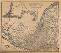 |
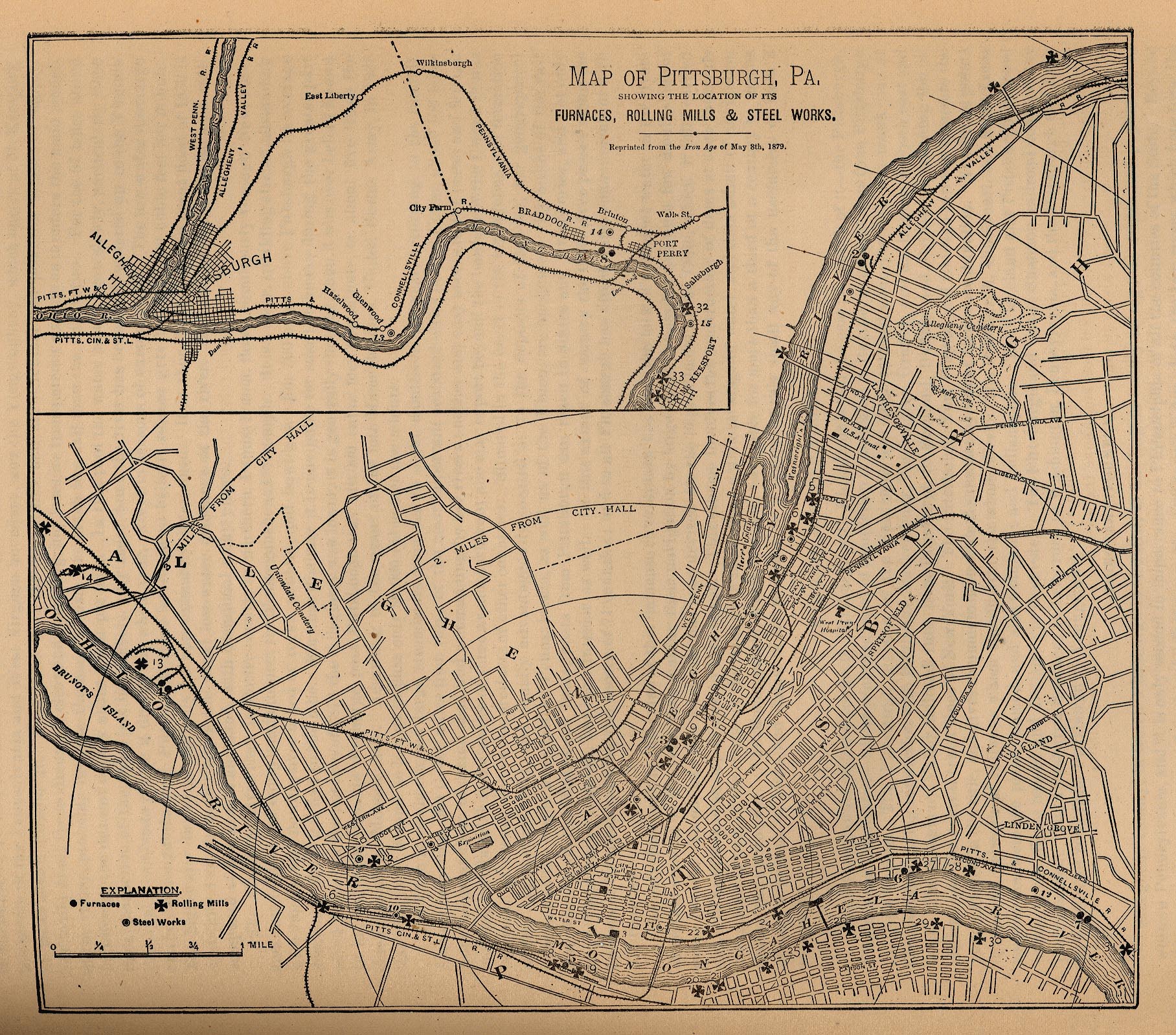
Pittsburgh - Map of
Pittsburgh, Pa., Showing the Location of its Furnaces, Rolling Mills
& Steel Works, Reprint from the Iron Age of May 8th, 1879 -
From George E. Waring, Jr. (comp.), Report on the Social
Statistics of Cities (U.S. Census Office, 1887) (962kb) |
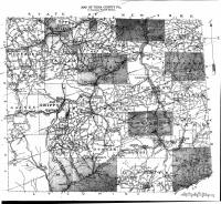 |
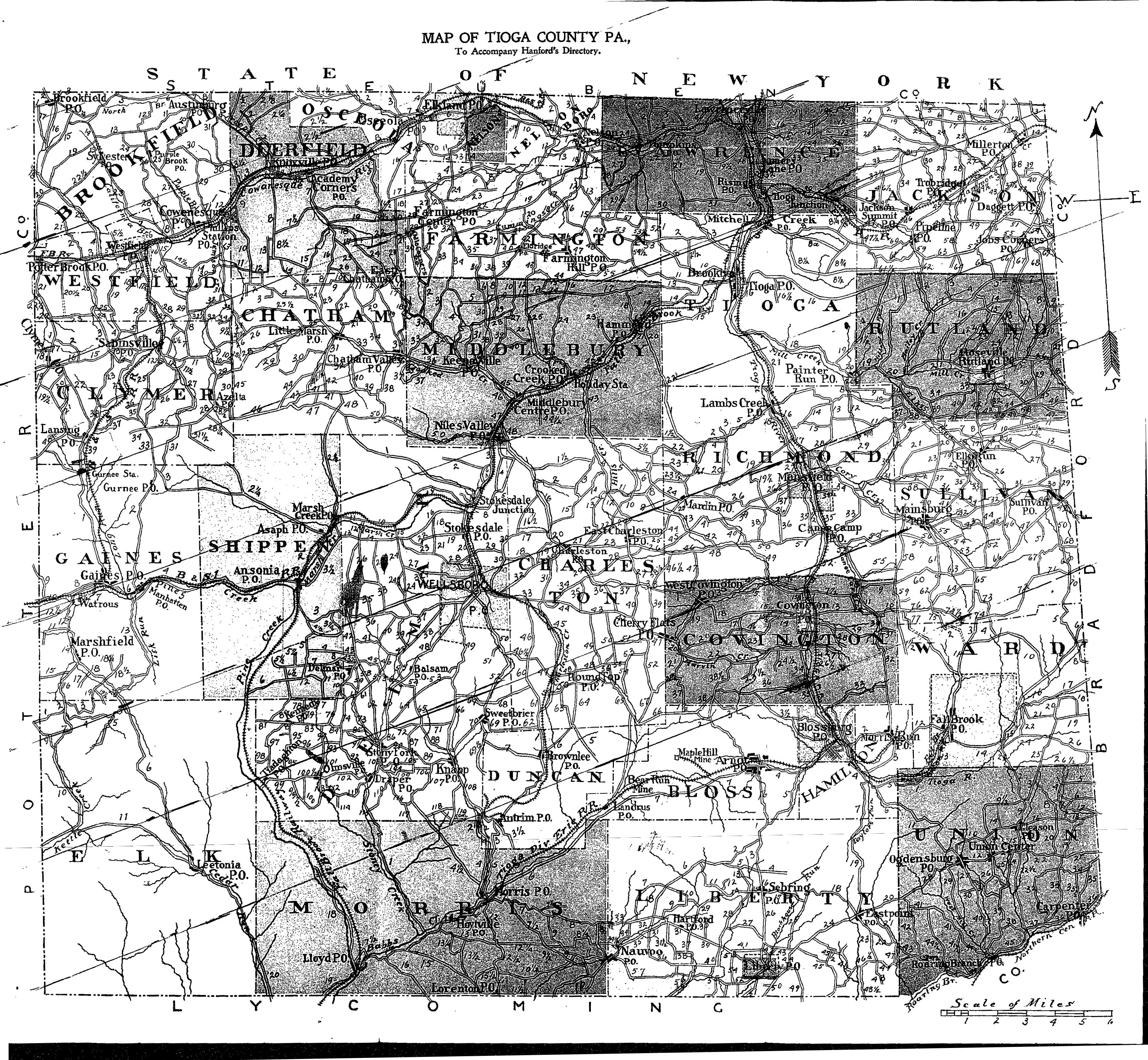
Tioga County - Map of
Tioga County, Pa. (Elmira, NY: George Hanford, 1899) (2.7Mb)
|
 |
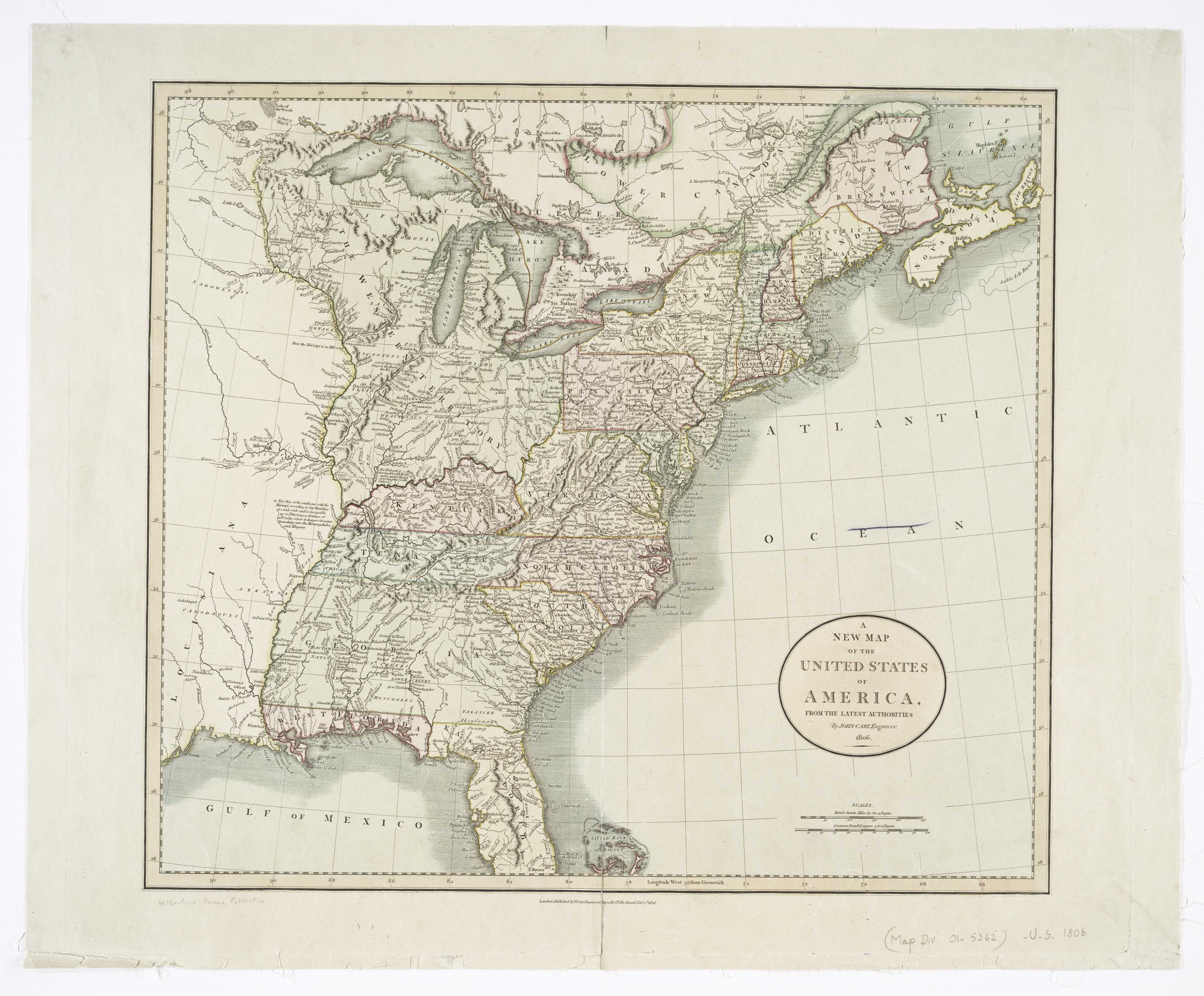
United States - A New Map
of the United States of America, from the Latest Authorities, 1806
(London: J. Cary, 1806) (1.8Mb) |
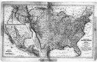 |
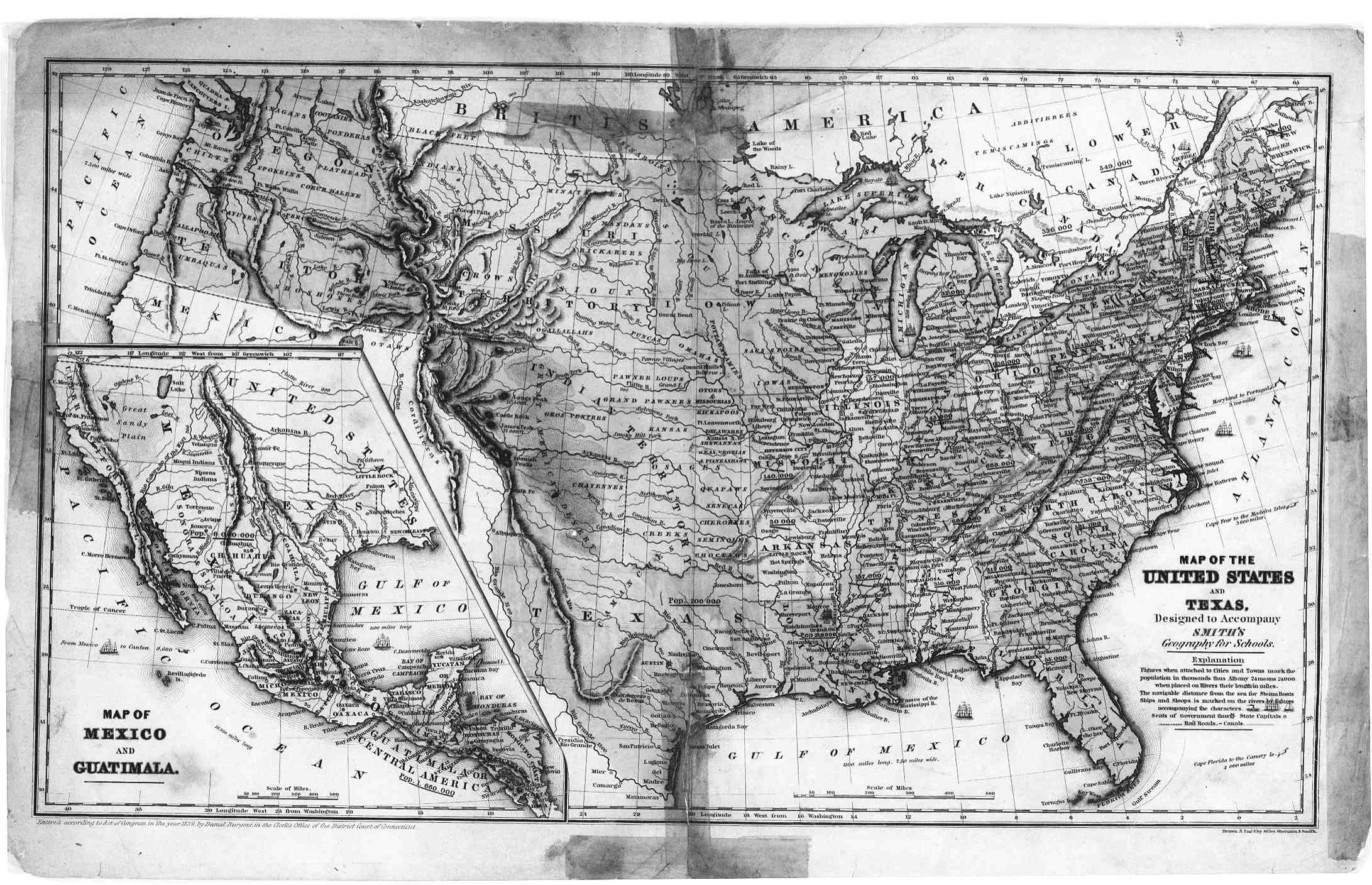
United States - Map of the
United States and Texas, Designed to Accompany Smith's Geography for
Schools - Daniel Burgess (1839). |


.gif)